- Home
- About Us
- Announcements
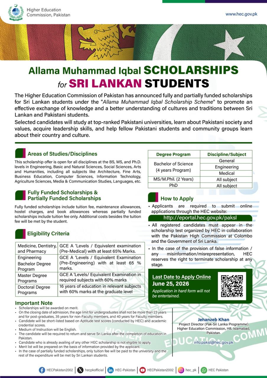
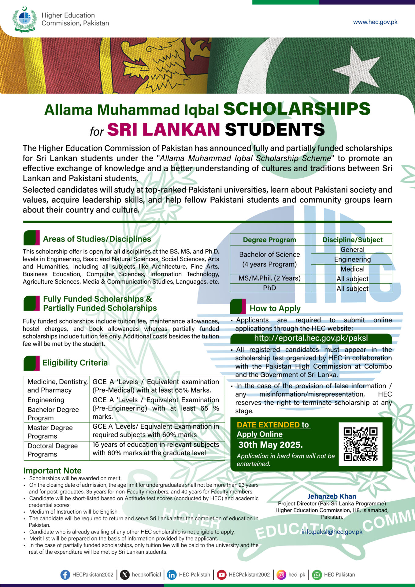
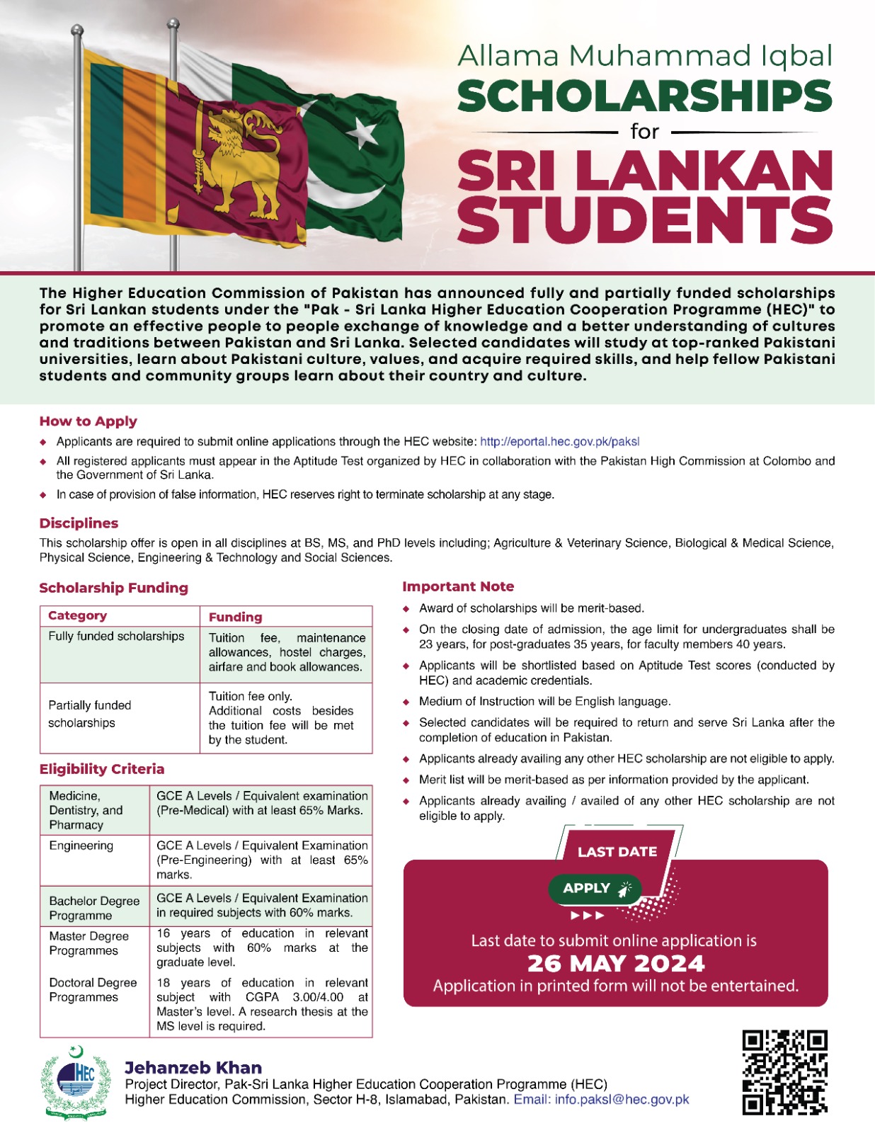
- Allama Muhammad Iqbal Scholarship
- Vacancy – Chairman / Dean
- FOODAG 2025
- Flag Hoisting Ceremony
- Pakistan International Maritime Expo and Conference (PIMEC) – 2025
- Allama Iqbal Scholarship
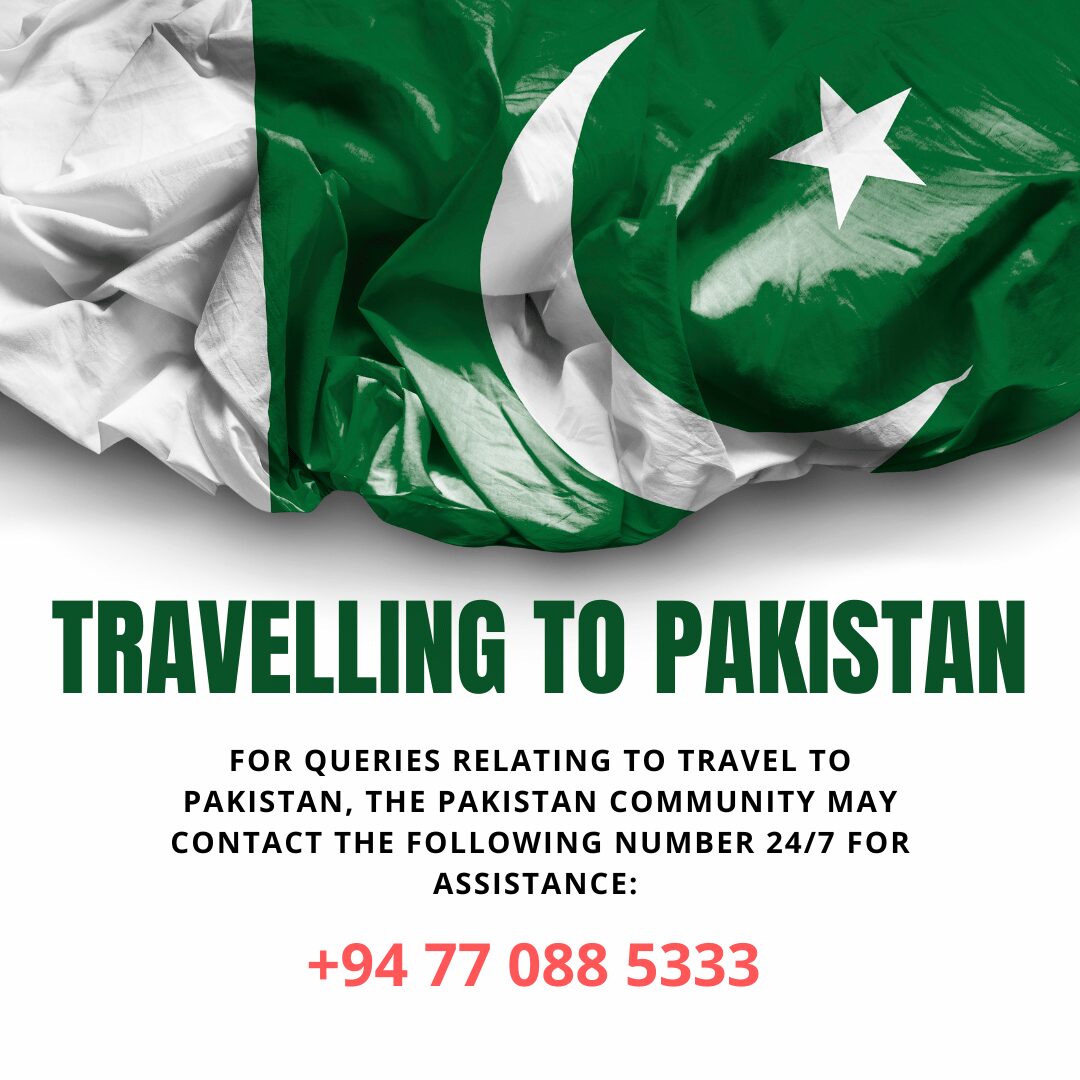
- Travelling to Pakistan
- E-Kachehri
- INIVITATION FOR BIDS – NATIONAL SALT LTD
- Flag Hoisting Ceremony
- E-Kachehri
- Awareness of Hajj 2025 Sponsorship Scheme
- 5th International Textile & Leather Exhibition 2024
- Online Driving License
- 2ND INTERNATIONAL FOOD AND AGRICULTURE EXHIBITION
- Deadline for Sponsorship Scheme of Hajj for Overseas Pakistanis Extended
- 4th INTERNATIONAL TEXTILE EXHIBITION
- Pakistan’s Citizen Portal
- Pakistan General Election 2024
- BAHRIA UNIVERSITY ADMISSION CALL TO INTERNATIONAL STUDENTS FOR ENROLLMENT IN SPRING 2023 SEMESTER
- TENDER NOTICE – DP KW3195
- TENDER NOTICE – DESKTOP PC
- 2nd Engineering & Health CareShow
- TENDER NOTICE – SEWING MACHINES
- TENDER NOTICE – RATION PACKS
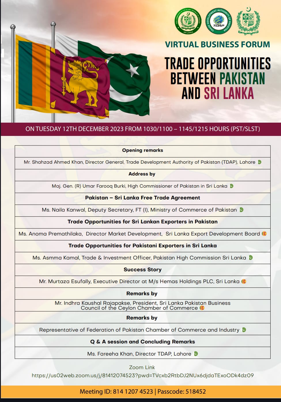
- Virtual Business Forum – Trade Opportunities between Pakistan and Sri Lanka
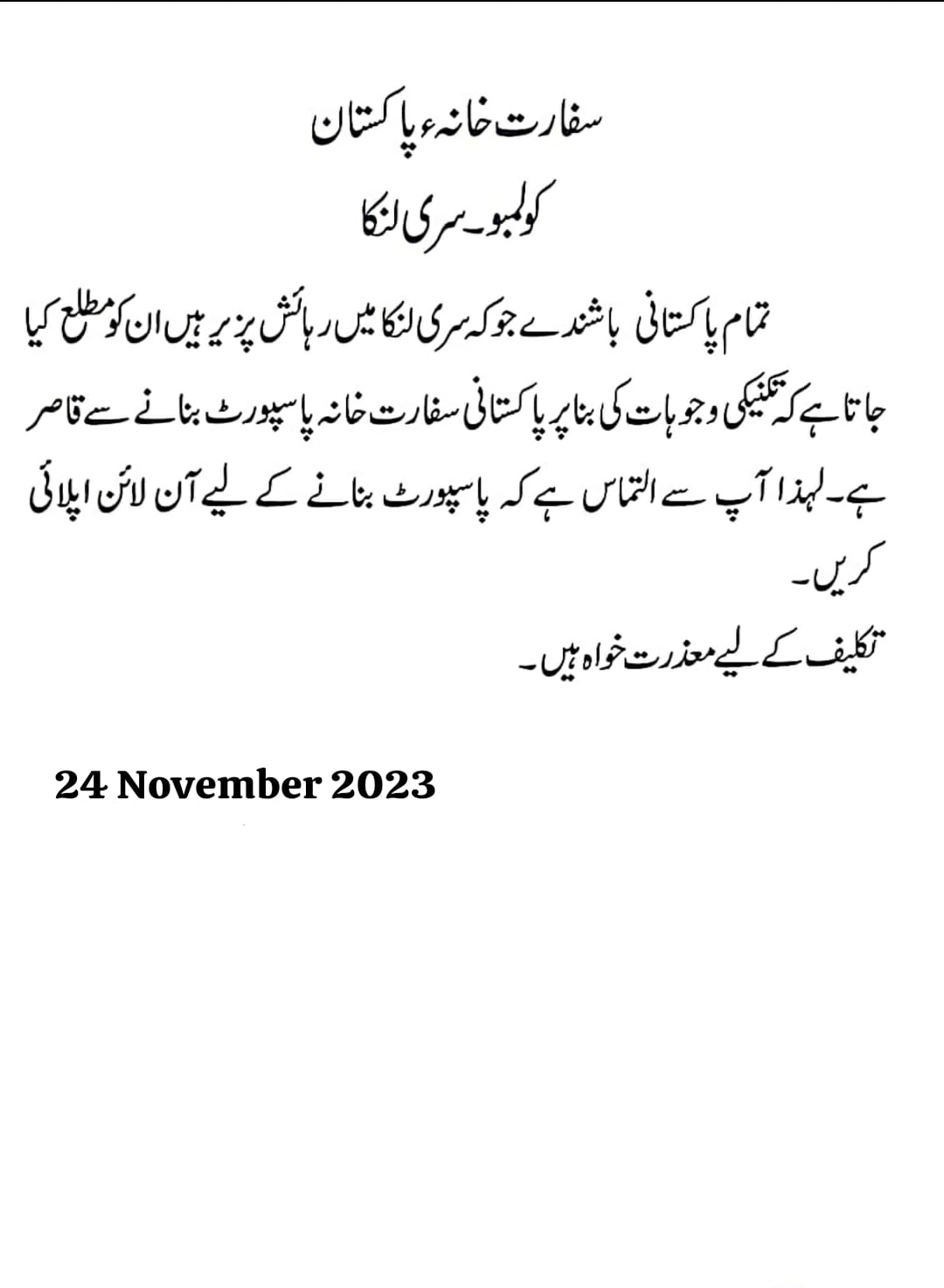
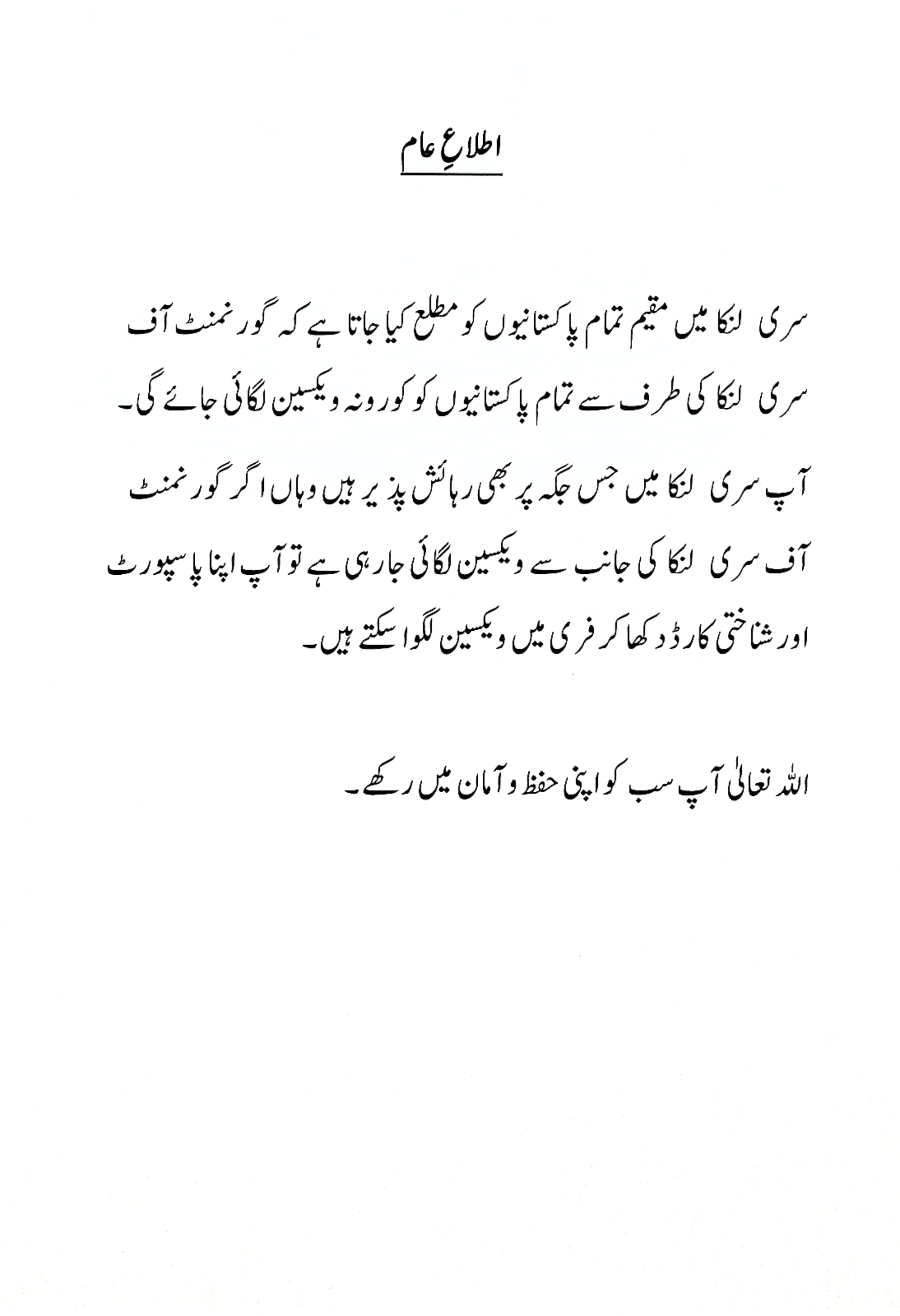
- Important Announcement
- Public Notice
- International Housing Expo 2022 – (Pakistan 8-10 December 2022)
- Lists of required Medicines & relief items for flood affectees
- Important Announcement
- Details & list of IBANs of Prime Minister’s Flood Relief Fund Accounts
- Promote bilateral trade and investment opportunities with Pakistan
- Urgent Appeal for Flood Relief Donation
- Kashmir Black Day 27th October 2023
- Tests Schedule for Allama Iqbal Scholarship
- Gandhara Seminar 2023
- Important Announcement
- Notice
- Revision of Inbound travel
- International Food and Agro Exhibition-August-2023
- Islamabad Security Dialogue 2022
- TDAP Launched Pakistan Trade Portal
- BROCHURE and APPLICATION FORM
- 10TH WEXNET WOMEN ENTREPRENEURS EXHIBITION 2022
- Revision of Inbound Policy
- DIGISKILLS.PK 2.0 PAKISTAN
- Virtual Pakistan Export Gallery
- Selection of Trade and Investment Officers for Posting at Pakistan’s Trade Missions Abroad, 2021
- NADRA PAK IDENTITY SERVICES FOR OVERSEAS PAKISTANI
- Opening of Federal Tax Ombudsman Facilitation Desk
- Automation of Power of Attorney
- Self finance Colleges for MBBS and BDS
- ACCESS TO IRIS FOR OVERSEAS PAKISTANIS
- Important Announcement 1
- Important Announcement 2
- ISLAMABAD SECURITY DIALOUGE 17th-18th March 2021
- Revised Covid-19 Guidelines Concerning Inbound Travel to Pakistan
- Revised Passport Fee
- Revised Passport Fee
- Directory of Engineering Goods Exporters-2020
- Online Visa
- AWARENESS – NADRA OFFICIAL WEBSITE
- VISA EXTENTION POLICY DUE TO COVID-19 IN SRI LANKA (ISSUED BY THE IMMIGRATION & EMMIGRATION DEPARTMENT OF SRI LANKA)
- Roshan Digital Account
- Pakistan Citizen’s Portal
- SOPs-Guidelines-for-International-Passengers
- TEN BILLION TREE TSUNAMI PROGRAMME
- Federal Tax Ombudsman
- Ehsaas Emergency Cash Program contributes largely for welfare of vulnerable segments
- Consular Affairs
- Media Center
- Scholarships
- Allama Muhammad Iqbal Scholarship
- Allama Iqbal Scholarship’s updated entry test schedule
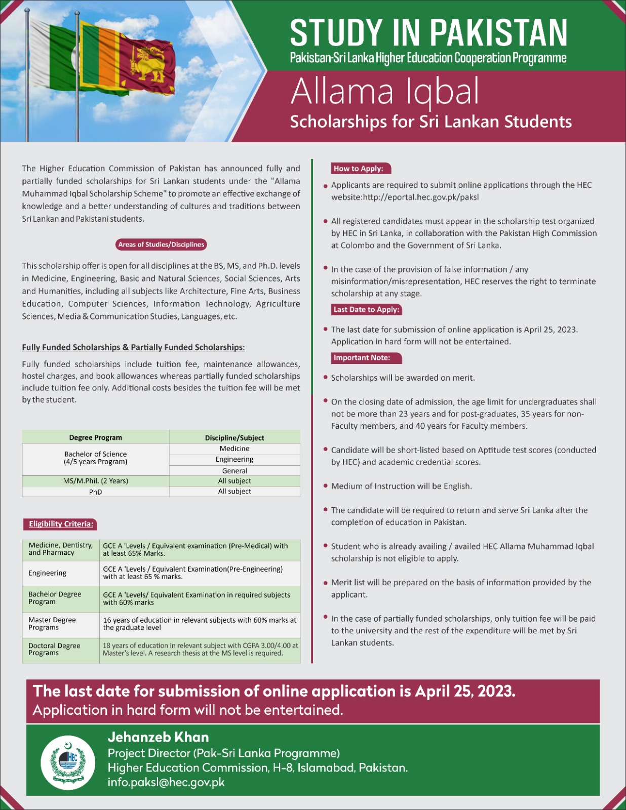
- Allama Muhammad Iqbal Scholarships -for Sri Lankan Students – 2024
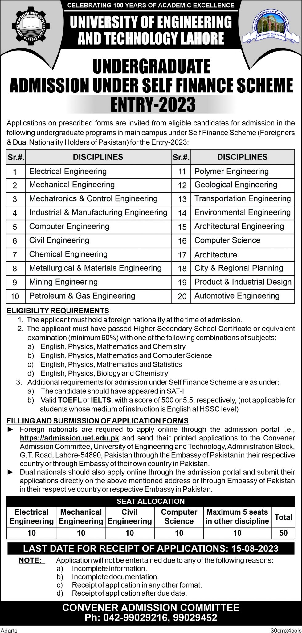
- Admission-2023 University of Engineering and Technology Lahore
- Jinnah Scholarships 2023
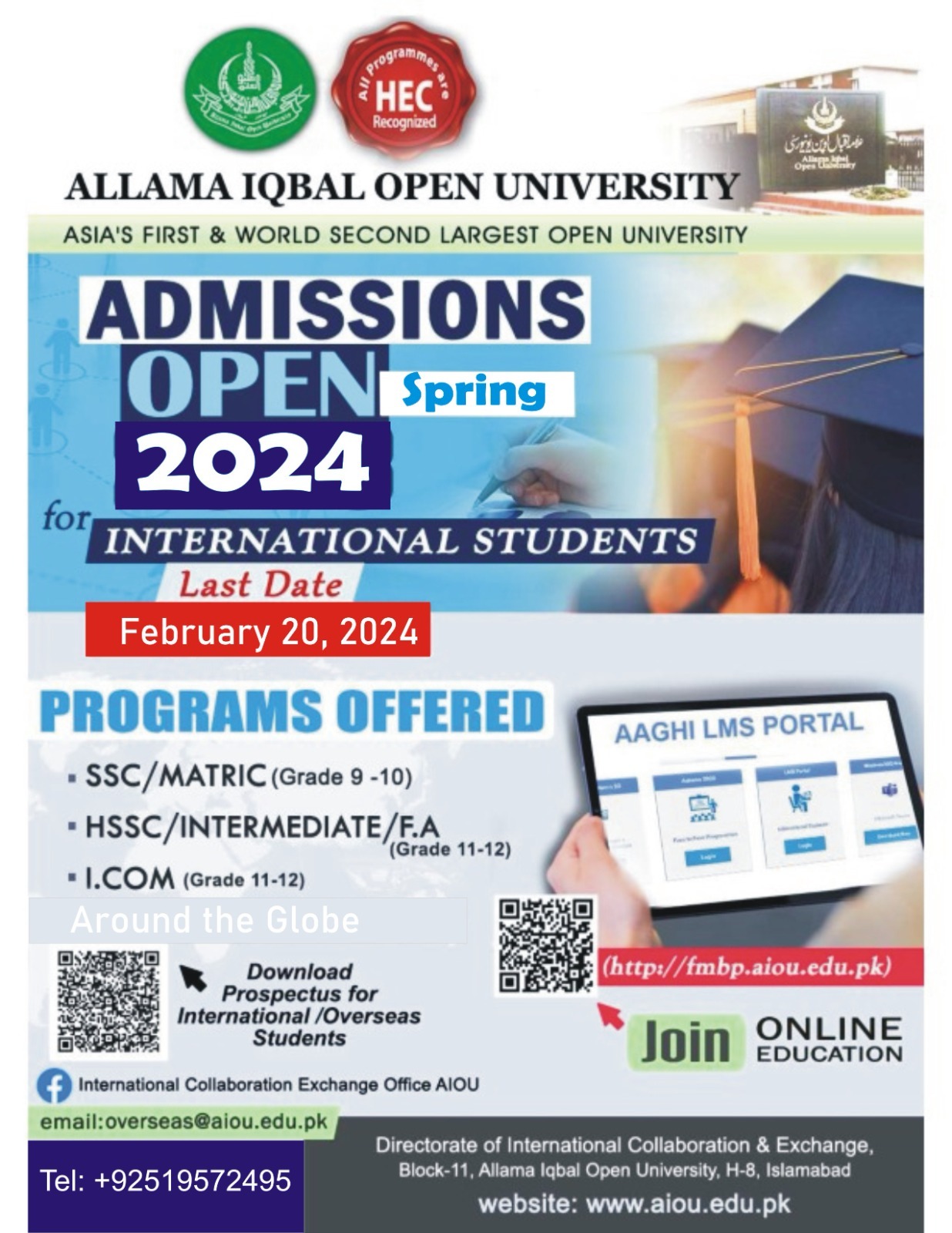
- Allama Iqbal Open University – Admission Open 2024 for International Students
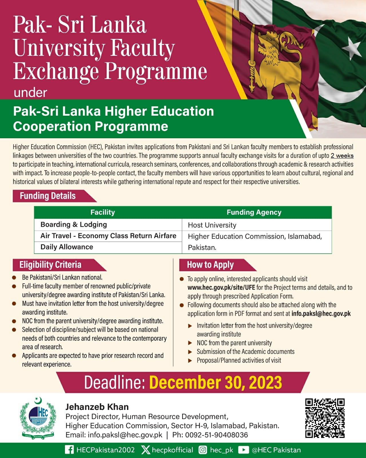
- Pak-Sri Lanka Faculty Exchange Program
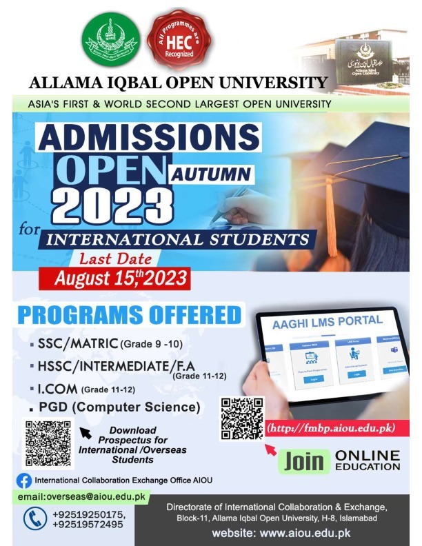
- Allama Iqbal Open University – Admission Open 2023
- Allama Iqbal Scholarship-2023
- Allama Iqbal University offering 2023 Educational Programs for International students around the Globe
- Tests Schedule for Allama Iqbal Scholarship
- Masters and Allama Iqbal Open University Pakistan for FA and Matric
- Allama Iqbal Open University Pakistan for Bachelors
- COMSATS University Islamabad Scholarship
- ALLAMA IQBAL SCHOLARSHIP 2021
- Publications
- Visit Pakistan
- Government
- CW NEW
Country Profile
Introduction of Pakistan
Pakistan displays some of Asia’s most magnificent landscapes as it stretches from the Arabian Sea, its southern border, to some of the world’s most spectacular mountain ranges in the north. Pakistan is also home to sites that date back to word’s earliest settlements rivaling those of ancient Egypt and Mesopotamia.
Location
Located in South Asia, Pakistan shares an eastern border with India and a north-eastern border with China. Iran makes up the country’s south-west border, and Afghanistan runs along its western and northern edge. The Arabian Sea is Pakistan’s southern boundary with 1,064 km of coastline.
The country has a total area of 796,095 sq km and is nearly four times the size of the United Kingdom. From Gwadar Bay in its south-eastern corner, the country extends more than 1,800 km to the Khunjerab Pass on China’s border.
Basic Facts
Official Name Islamic Republic of Pakistan
Father of the nation : Quaid-i-Azam Muhammad Ali Jinnah (1876-1948)
National Poet Allama Muhammad Iqbal (1877-1938)
Head of the State President
Head of Government Prime Minister
Capital Islamabad (See http://www.cda.gov.pk)
Total Area 796,095 Sq. km.
Population 165 million (estimated)-132 million (1998 census) (See http://www.statpak.gov.pk/)
Pakistan is divided into four provinces viz., Khyber Pukhtoonkhwa, Punjab, Sindh and Balochistan. The tribal belt adjoining Khyber Pukhtoonkhwa is managed by the Federal Government and is named FATA i.e., Federally Administered Tribal Areas. Azad Kashmir and Northern Areas have their own respective political and administrative machinery, yet certain of their subjects are taken care of by the Federal Government through the Ministry of Kashmir Affairs and Northern Areas. Provinces of Pakistan are further divided into Districts
Religion 95% Muslims, 5% others.
GDP 5.8%
Currency Pak. Rupee.
Imports
Industrial equipment, chemicals, vehicles, steel, iron ore, petroleum, edible oil, pulses, tea.
Exports
Cotton, textile goods, rice, leather items carpets, sports goods, handi-crafts, fish and fish prep. and fruit
Languages
Urdu (National) and English (Official)
Literacy rate 53%
Government Parliamentary form
Parliament
Parliament consists of two Houses i.e., the Senate (Upper House) and the National Assembly (Lower House).
The Senate is a permanent legislative body and symbolises a process of continuity in the national affairs. It consists of 100 members. The four Provincial Assemblies, Federally Administered Tribal Areas and Federal Capital form its electoral college.
The National Assembly has a total membership of 342 elected through adult suffrage (272 general seats, 60 women seats and 10 non-Muslim seats).
Pakistan National Flag
Dark green with a white vertical bar, a white crescent and a five-pointed star in the middle. The Flag symbolizes Pakistan’s profound commitment to Islam, the Islamic world and the rights of religious minorities.
National Anthem Approved in August, 1954
Verses Composed by: Abdul Asar Hafeez Jullundhri
Tune Composed by: Ahmed G. Chagla
Duration: 80 seconds (For more details click here)
State Emblem The State Emblem consists of:
1. The crescent and star which are symbols of Islam
2. The shield in the centre shows four major crops
3. Wreath surrounding the shield represents cultural heritage and
4. Scroll contains Quaid’s motto: Faith, Unity, Discipline (For more details click here) Pakistan’s Official Map
Drawn by Mian Mahmood Alam Suhrawardy (1920-1999)
National Flower
Jasmine.
National Tree
Deodar (Cedrus Deodara).
National Animal
Markhor.
National Bird
Chakor (Red-legged partridge)
Flora
Pine, Oak, Poplar, Deodar, Maple, Mulberry
Fauna
The Pheasant, Leopard, Deer, Ibex, Chinkara, Black buck, Neelgai, Markhor, Marco-Polo sheep, Green turtles, River & Sea fish, Crocodile, Waterfowls
Popular games
Cricket, Hockey, Football, Squash.
Tourist’s resorts
Murree, Quetta, Hunza, Ziarat, Swat, Kaghan, Chitral and Gilgit
Archaeological sites
Moenjo Daro, Harappa, Taxila, Kot Diji, Mehr Garh, Takht Bhai.
Major Cities
Islamabad, Karachi, Lahore, Peshawar, Quetta, Rawalpindi, Hyderabad, Faisalabad, Multan and Sialkot
Major Crops
Cotton, Wheat, Rice and Sugarcane
Agricultural Growth Rate
4.1 % on the average for the last six years–1.5% in 2007-08
Total cropped area
25.01 million hectares
Industry
Textiles, Cement, Fertiliser, Steel, Sugar, Electric Goods, Shipbuilding
Famous Mountain Peaks
| Name |
Height |
World Rating |
| K-2 (Chagori) |
8616 m |
2nd |
| Nanga Parbat |
8125 m |
8th |
| Gasherbrum-I |
8068 m |
11th |
| Broad Peak |
8065 m |
12th |
| Gasherbrum-II |
8047 m |
14th |
| Gasherbrum-III |
7952 m |
15th |
| Gasherbrum-IV |
7925 m |
16th |
| Disteghil Sar |
7885 m |
20th |
| Kunyang Kish |
7852 m |
22nd |
| Masherbrum (NE) |
7821 m |
24th |
| Rakaposhi |
7788 m |
27th |
| Batura I |
7785 m |
28th |
| Kanjut Sar |
7760 m |
29th |
| Saltoro Kangri |
7742 m |
33rd |
| Trivor |
7720 m |
36th |
| Tirich Mir |
7708 m |
41st |
Famous Mountain Passes
| Location | Province |
| The Khyber Pass | Khyber Pukhtoonkhwa |
| The Kurram Pass | FATA |
| The Tochi Pass | FATA |
| The Gomal Pass | Khyber Pukhtoonkhwa |
| The Bolan Pass | Balochistan |
| The Lowari Pass | Chitral (Khyber Pukhtoonkhwa) |
| The Khunjrab Pass | Northern Areas |
Rivers
| Name | Length |
| The Indus | 2,896 km |
| Jhelum | 825 km |
| Chenab | 1,242 km |
| Ravi | 901 km |
| Sutlej | 1,551 km |
| Beas (tributary of Sutlej) | 398 km |
Famous Glaciers
| Name | Length |
| Siachin | 75 km |
| Batura | 55 km |
| Baltoro | 65 km |
Deserts
| Name | Location/Province |
| Thar | Sindh |
| Cholistan | Punjab |
| Thal | Punjab |
Lakes
| Name | Location/Province |
| Manchar | Sindh |
| Keenjar | Sindh |
| Hanna | Balochistan |
| Saif-ul-Maluk | Khyber Pukhtoonkhwa |
| Satpara | Northern Areas |
| Kachura | Northern Areas |
Major Dams
| Name | Location/Province |
| Mangla Dam | Punjab |
| Tarbela Dam | Khyber Pukhtoonkhwa |
| Warsak Dam | Khyber Pukhtoonkhwa |
Important Links
Pakistan's Official Media
-
Visitor Count


